
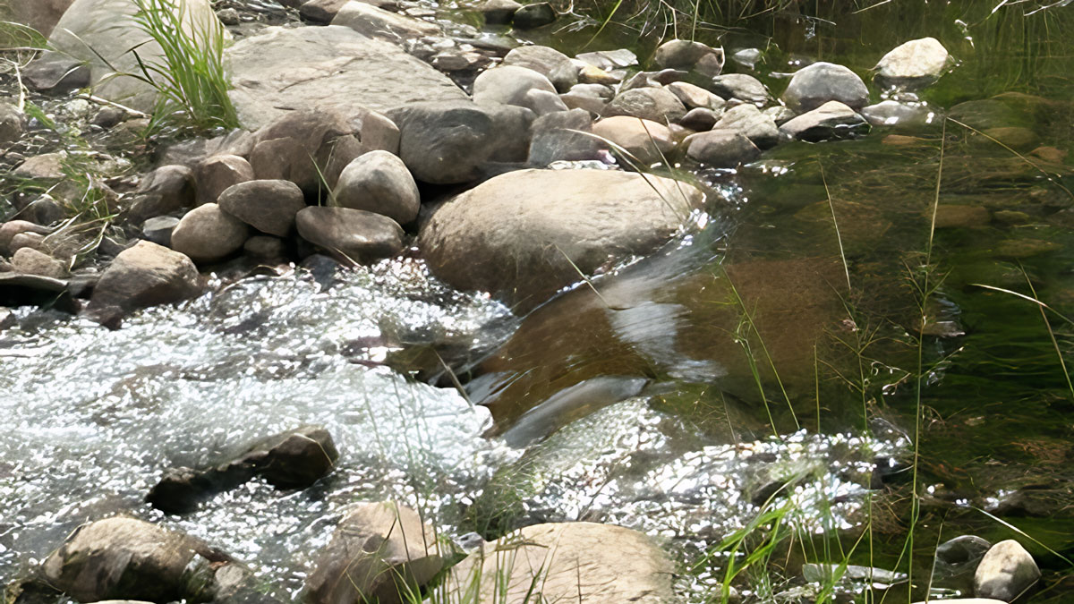
As of Monday August 10, water continues to flow over the rock arch rapids (RAR) outlet in Longville. It’s not down to a trickle and won’t be until the lake lowers approximately 9 – 14 more inches. So, the “drain-down-phase” continues. More on this in a bit.
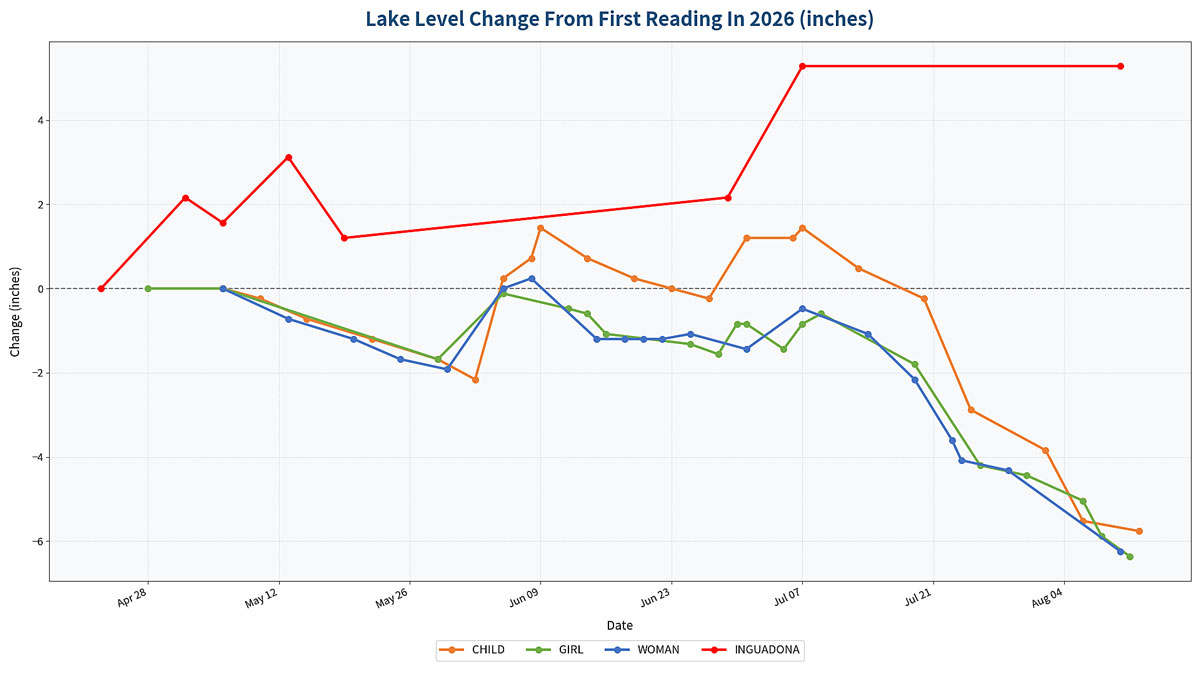
After compiling lake level data from late April to August, I expected to see water levels drop as evidence by the 6 feet of new shoreline I have on Girl which I haven’t seen in my 21 years being on the lake. The raw data was given to our team’s technical expert and out popped the following graph that shows water level changes in inches for several lakes.
As expected, Woman and Girl have dropped significantly. From July 1 through August 11, Girl has dropped 5.52 inches, Woman Lake is down 4.8 inches and Child has dropped 5.76 inches.
Then the most recent water levels were plugged in from Inguadona. From April 23 to August 10, lake levels increased by 5.28 inches! Either a beaver is at work on the outlet leading to Boy Lake, rain bypassed the Woman Lake Chain and landed on Inguadona or…maybe the Boy River outflow in Longville is contributing to the increase. I don’t know. It is just interesting that the DNR states “we are in a severe drought, all the lakes around here are suffering” statement, but why is Inguadona’ s water level up? Hmmm… To help me sleep tonight, I’ll blame it on a beaver.
Now back to the RAR and when will it stop spilling water?
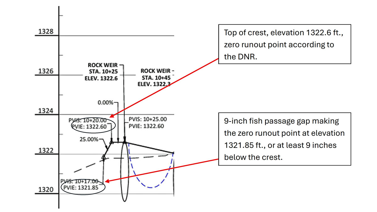
The DNR says it matched the new crest (top of the rocks where water starts to spill/flow over) with the old dam crest. That elevation is 1322.6 ft. They had a slide in their June 25 presentation showing “existing conditions” and “proposed conditions” as evidence to back up their statement that the RAR will have zero water flow at 1322.6 ft.

There’s one problem. The RAR has fish passage gaps between the rocks that extend down to approximately 9 inches. Instead of 1322.6, zero water flow is more likely to be 1321.85; which is 9 inches lower than the top of the crest.
Again, referencing the DNR presentation on June 25, slide 10 showed the top runout elevation 1322.6 and it also showed the 9” drop between the rocks in the crest and the lowest elevation of 1321.85 ft.
So, when will the water stop flowing over the RAR? I don’t know. My eyes have seen the old dam nearly dry up when the inflow was down, evaporation was high and we were in periods of low to no rain. With the new RAR…roll the dice. In the meantime, be prepared to pull boats, move docks and witness the new shoreline many are seeing for the first time in ages. Inguadona readers, you have any extra beavers you could send our way?